PESQUISAR ESTE BLOG

Mostrando postagens com marcador River. Mostrar todas as postagens

Angelina River

The Angelina River is formed by the junction of Barnhardt and Shawnee creeks 3 miles (5 km) northwest of Laneville in southwest central Rusk County, Texas.

Angelina River.

The river flows southeast for 120 miles (193 km) and forms the boundaries between Cherokee and Nacogdoches, Angelina and Nacogdoches, and Angelina and San Augustine counties. It passes under US 59 via former Angelina River Bridge. It empties into the Neches River 12 miles (19 km) north of Jasper in northwestern Jasper County.

The Sam Rayburn Reservoir is on the southern part of the river.

John Day River

The John Day River is a tributary of the Columbia River, approximately 284 miles (457 km) long, in northeastern Oregon in the United States. It is known as the Mah-Hah River by the Cayuse people, the original inhabitants of the region. Undammed along its entire length, the river is the fourth longest free-flowing river in the contiguous United States. There is extensive use of its waters for irrigation. Its course furnishes habitat for diverse species, including wild steelhead and Chinook salmon runs.[4][7] However, the steelhead populations are under federal Endangered Species Act (ESA) protections, and the Chinook salmon have been proposed for such protection.
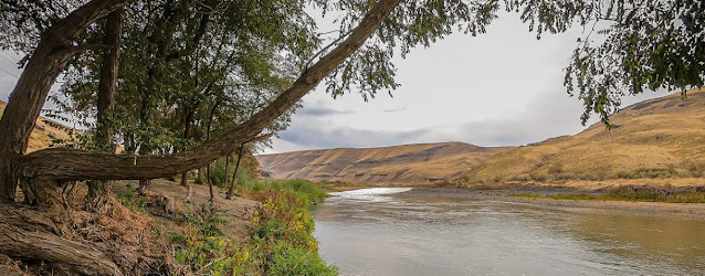

The river was named for John Day, a member of the Pacific Fur Company's overland expedition to the mouth of the Columbia River that left Missouri in 1810. Day struggled through eastern Oregon during the winter of 1811–12. While descending the Columbia River in April 1812, he and Ramsay Crooks were robbed and stripped naked by Native Americans at the mouth of the river that now bears his name, forcing them to hike 80 miles (130 km) back to friendly Umatilla Indians under extreme conditions.

The absence of dams on the river causes its flow to greatly fluctuate throughout the year depending on snowpack and rainfall within the watershed. The highest flow recorded at a gauge on the lower John Day was 43,300 cubic feet per second (1,230 m3/s) on January 2, 1997. The lowest flow was no flow at all, which occurred on September 2, 1966; from August 15 to September 16, 1973; and on nine days in August 1977. The average flow at the gauge is 2,075 cubic feet per second (58.8 m³/s).

Nushagak River

The Nushagak River is a river in southwest Alaska, United States. It begins in the Alaska Range and flows southwest 450 km (280 mi) to Nushagak Bay, an inlet of Bristol Bay, east of Dillingham, Alaska.

The Mulchatna River is a major tributary. Other navigable tributaries include the Nuyakuk River and the King Salmon River.


Jet-boats are commonly used to access these tributaries and the upper Nushagak. The Wood River, Iowithla River and the Kokwok River are smaller tributaries.

The villages of Portage Creek, Ekwok, Koliganek and New Stuyahok are on the river. The town of Dillingham is on Nushagak Bay.

Five species of Pacific salmon (Chinook, coho, sockeye, chum, and pink) spawn in the river or its tributaries. Commercial, subsistence and sport fishing are important in the area. Most notable is the annual run of king (Chinook) salmon which occurs from mid-June to mid-July. Rainbow trout, northern pike, grayling, burbot, whitefish and Arctic char are also present in the Nushagak. It is estimated that over 50% of the world's production of wild salmon is harvested in the Nushagak River and the Bristol Bay area.

Skwentna River


The Skwentna River (Dena'ina: Shqitnu) is a river in the southwestern part of Matanuska-Susitna Borough, Alaska.

Wulik River

The Wulik River is a stream, about 80 miles (130 km) long, in the northwestern part of the U.S. state of Alaska. Originating in the De Long Mountains in the North Slope Borough, it flows southwest to Kivalina Lagoon in the Chukchi Sea, east of Kivalina. It heads in the De Long Mountains, which is 5 miles (8 km) north of Sheep Mountain, and it is 42 miles (67 km) northwest of Noatak.


Umiak Bend, along the river and 8 miles (13 km) northwest of Kivalina, was named after an Inuit skin boat (umiak) was destroyed there by rough water. In 1886, a United States Navy lieutenant reported the Inuit name of this river as "Woleek."

Unuk River

The Unuk River is a river in the U.S. state of Alaska and the Canadian province of British Columbia. It flows from the Coast Mountains southwest to Behm Canal, northeast of Ketchikan, Alaska.


From its headwaters in a heavily glaciated area in British Columbia, south of the lower Iskut River, the Unuk flows west and south for 129 kilometres (80 mi), crossing into Alaska and emptying into Burroughs Bay, an inlet of Behm Canal. In Alaska the river flows through the Misty Fjords National Monument.

In Tlingit it is called Joonáx̱, the meaning of which is obscure but may have to do with dreaming (cf. aawajoon “he dreamed”). It is occasionally referred to as Oonáx̱, which is a reduced form. The USGS reports that a 1906 publication said the correct name for the river is “Junuk” or “Junock”, but it is unclear whether the initial sound is supposed to be an affricate  or an approximant . The former sound would reflect the full Tlingit name, the latter the English adaptation.

The Unuk River supports relatively large runs of salmon, including chinook, coho, pink, chum, and sockeye.